
Lehi People
Lehi City planners tour the Netherlands to experience transportation and land-use design
The Lehi City Director of Community Development, Kim Struthers, and Planning Division Manager, Mike West, recently returned from a whirlwind trip to the Netherlands. The two city leaders took the trip on their own dollar and time to experience all the Netherlands had to offer regarding transportation, land use planning and overall livability. Here is a little insight into what inspired them and their journey.
Lehi Free Press: What inspired the trip?
Mike West: Over the past two to three years, we have researched the Netherlands and how they approach mobility, land use, and their overall goals from the lens of city planning. After an initial interest in the Netherlands, we watched some videos about their planning on YouTube and were amazed by what we saw. These videos led to more research and a good amount of travel there via Google Earth. We did this research primarily at home on our own time, especially watching YouTube videos. Work doesn’t stop at 6 p.m. on the weekends for us; we regularly learn and try to improve ourselves as planners in our own time.
We learned that YouTube videos don’t often tell the whole story or show the big picture, so we sought other ways to find information about the Dutch approach. Research led us to find the Dutch Cycling Embassy. Its mission is to utilize its expertise to facilitate cycling worldwide.
We found DTV Consultants (a Dutch traffic engineering firm) through the Dutch Cycling Embassy network, which offers training courses to learn the five design principles to create a successful cycling network (from the Dutch Crow Design Manual for Bicycle Traffic).
The five principles include:
• Cohesion: A connected network gets you from anywhere to everywhere.
• Directness: Cycling routes should be as direct and convenient as possible.

• Safety: The safety of all road users, including cyclists,must be a top priority. This means separating users by speed and mass. Bikes should be separated from high-speed traffic with protected bike lanes or separate paths; avoiding car exhaust fumes and finding parallel low-traffic routes are preferred.
• Comfort: Riding a bike is a balancing act, and stops should be minimized – continuous cycling is the goal.
• Attractiveness: As much as possible, elements such as trees, water, low-traffic streets/routes, human-scalebuildings and design elements to create enjoyable environment to cycle. This is part of enticing people to cycle for more trips.
Since learning and understanding the principles, we advocate implementing these principles in Lehi’s Bike and Pedestrian Master Plan and our Transportation Master Plan. After learning about all this, we wanted to experience it ourselves and go beyond seeing it on a screen.
During this studying, I met my friend and mentor Paul, a retired college professor, through a YouTube comment who offered to take me on a virtual bike tour of the Netherlands. We set up a first meeting, and from there, we regularly met on video calls on the weekends and showed each other how things were done where we both live. He taught me to look beyond mobility andconsider how everything adds to the big picture. This includes elements such as preserving nature and open space andclustering development with a village concept where people’s daily needs are met within convenient walking and biking distance.
After all this learning, Kim and I decided to take a trip to see it ourselves. We found cheap airfare and had Paul’s help to plan lodging, what we saw, and where to go.
LFP: How was your overall experience?
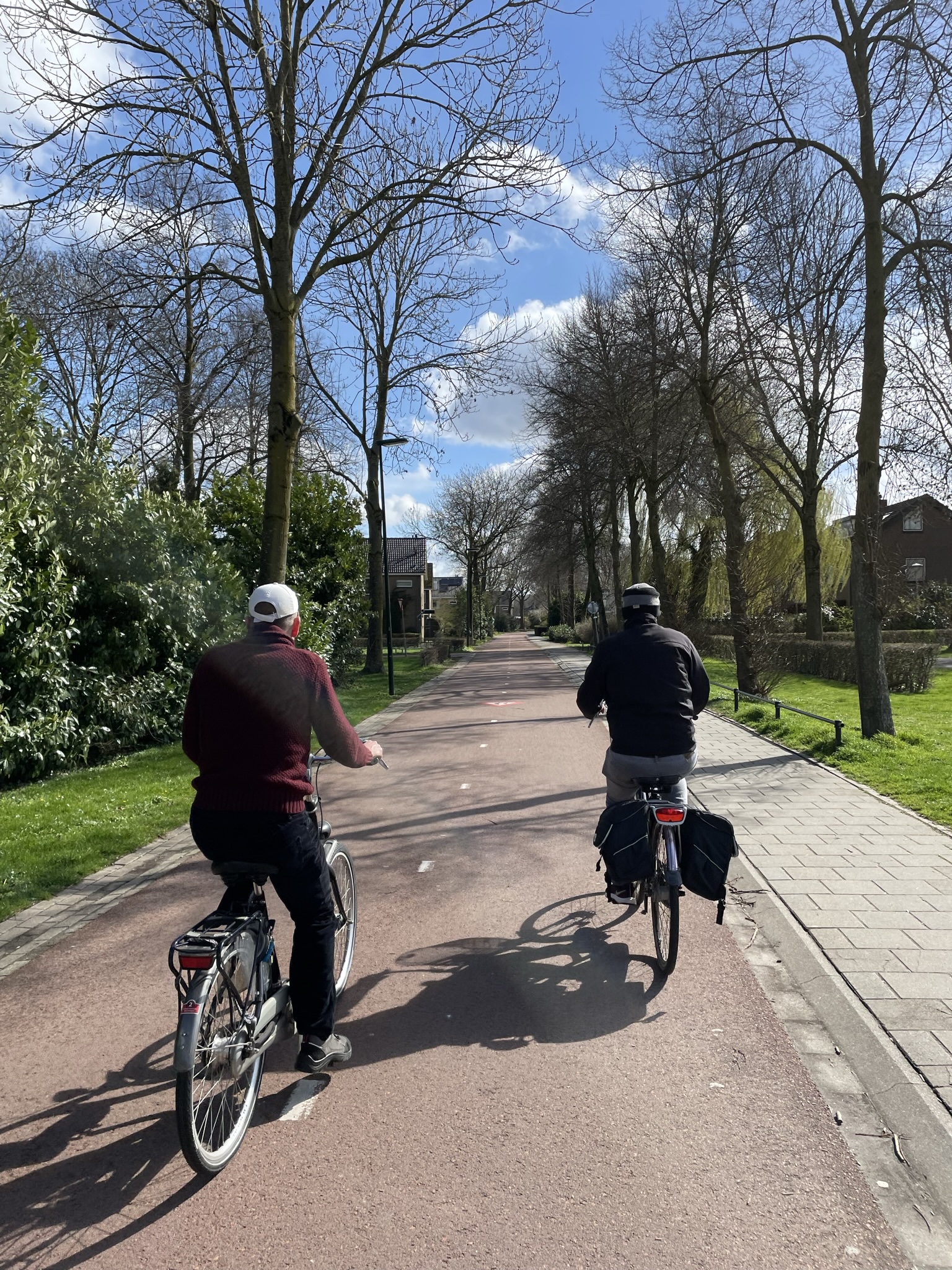
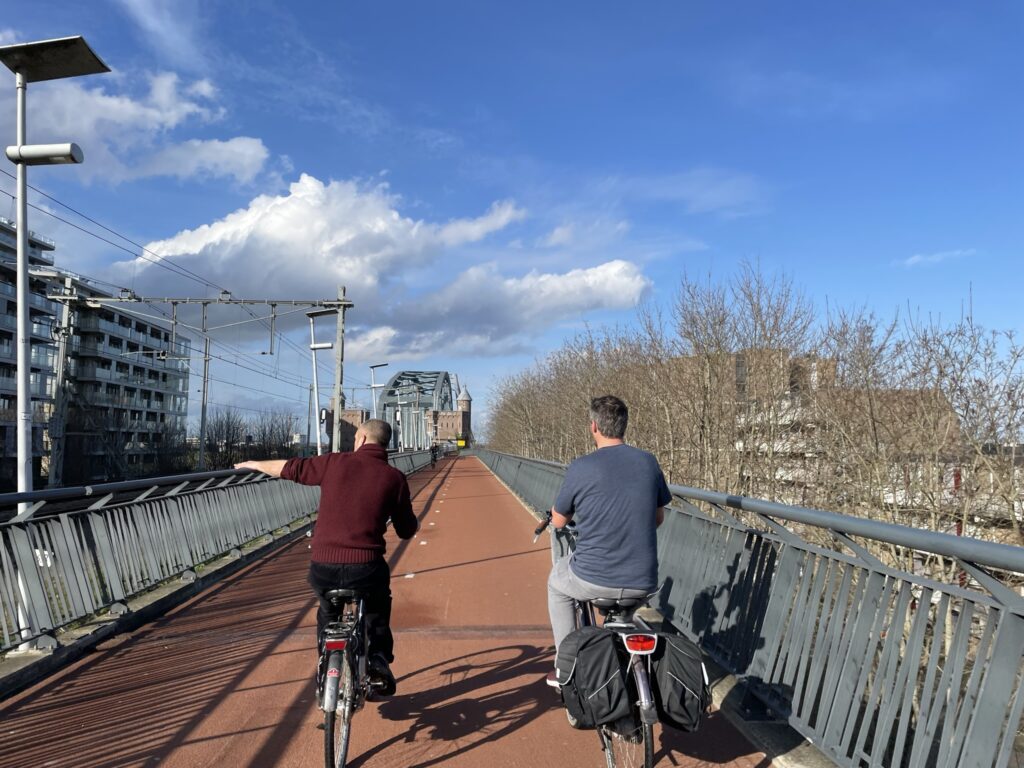
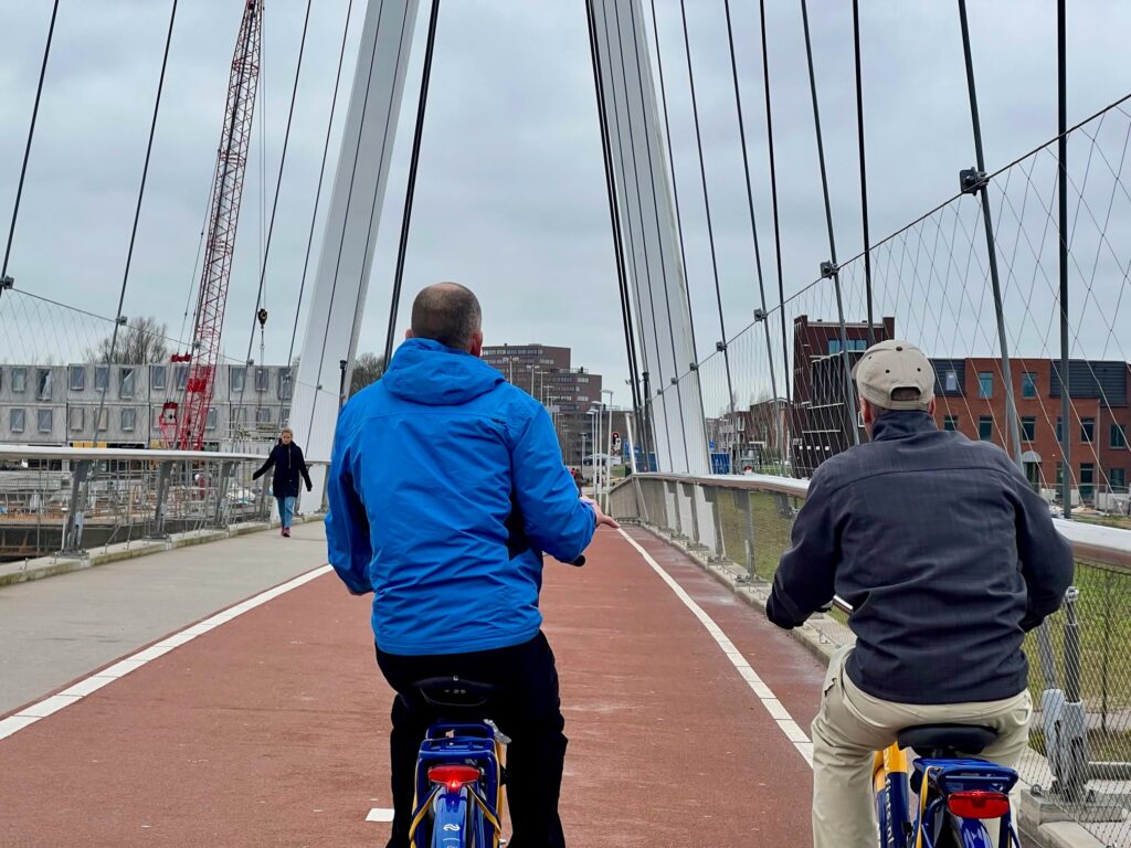
West: Overall, it was an amazing and eye-opening experience! We were on the move for seven straight days as there was so much to see and experience. We cycled over 280 miles through wind, rain, sleet, hail, and some sunny skies too. We also walked, took transit, and drove to many places because it’sessential to understand how the road networks and circulation all work in unison with other travel modes and land uses. Paul and the many people we stayed with and met were so kind and welcoming. Seeing cities in the Netherlands on video is one thing, but experiencing it is another story. I wouldn’t say thingsthere are perfect, no place is, but they have built a safer and genuinely multi-modal transportation system combined with land use planning that supports greater livability, safety, health, and many other goals.
LFP: What was your top takeaway in transportation and land use?
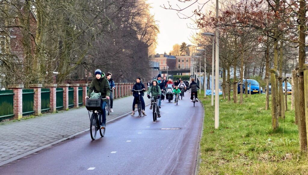
West: This is tough to answer since everything is so interrelated. The main takeaway with transportation is providing freedom of mobility for people of all ages and abilities. Our road networks in Utah are designed in an auto-prioritized manner that essentially forces people to use a car for most purposes since there are either no places or dangerous places to walk or bike, and public transportation coverage and frequencies are lacking.
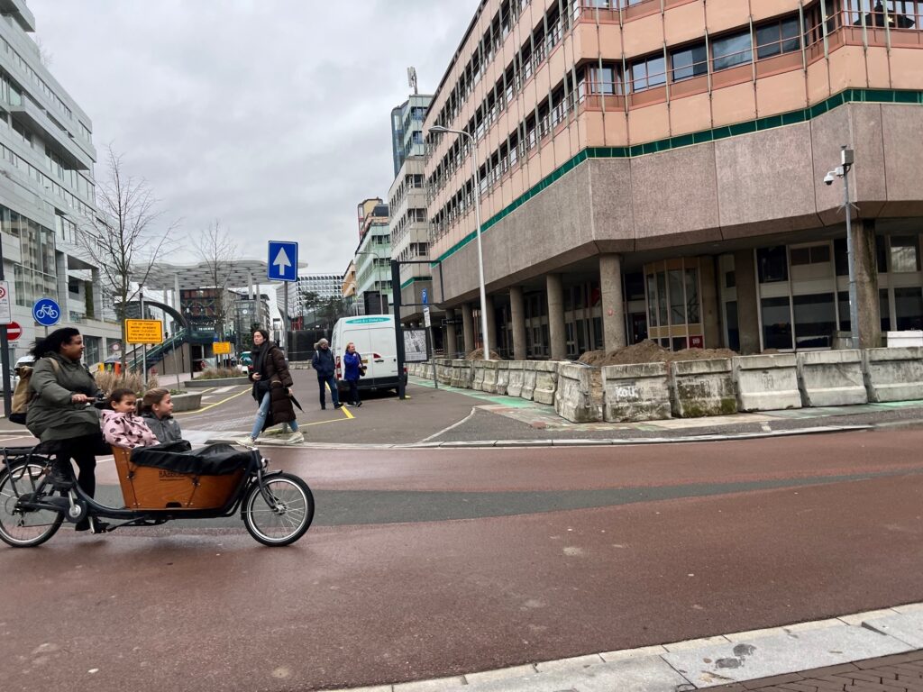
Sprawl land use practices make getting to destinations, especially everyday needs, more difficult by walking and biking due to longer travel distances. Cities in Utah often leave our youth counting down the days until they get their independence by obtaining a driver’s license, and our aging generations fear the loss of independence when they can no longer drive. Many people in Utah also can’t drive or can’t afford to drive and aresubjected to dangerous and demeaning conditions. It was amazing to see the Netherlands’ many wheelchairs, mobility devices, and other ways people used to get around on the bike network since it was much safer and well-connected.
Riding bikes along the streets and paths in the Netherlands was far more comfortable and enjoyable compared to the typical situations here in Utah. The wide roads we typically see here in Utah elicit unsafe driving behaviors, evident from traffic fatality rates in Utah and the US compared to places that have instituted a safety mindset in road design. The US has more than three times the traffic fatalities per capita than the Netherlands, asroad design and transportation priorities haven’t always been done so with the mindset of safety. The Netherlands designs roads appropriate for the surrounding context to better self-enforce safe speeds and removes dangerous conflict points.
I find that continual investment primarily in road networks continues to invite most people to drive and leads to more significant congestion at the cost of success in increased walking, biking, and transit use. Greater investment (not total investment) in walking, biking, and transit helps those modes succeed and can help improve the driving networks since the other modes of travel are more space efficient and lead to fewer cars congesting the roads. It is interesting to note that many Dutch people and families still own cars. They just don’t need to use them for most trips since other safe and convenient options exist.
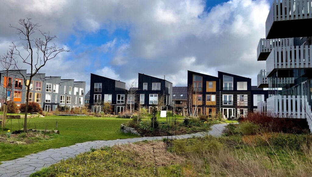
At the end of the day, I found that the transportation system provides options that better support goals of livability, public health, socialization, and greater independence for people of all ages and abilities. What stands out from a land use perspective is the way the Dutch cluster much of their newer neighborhoods to provide a variety of housing options for people in different life stages and situations and the preservation of open and public spaces.
The suburbs of the Netherlands are generally more compact than in the US, but they implement key elements to support a higher quality of life. When considering more compact neighborhoods, there is often a negative connotation around “density” in the US. Housing and population density is simply a metric to measure how many units or people are in a specified area. Still, it doesn’t say much about the built environment and its implications on the quality of life. The layout of housing, open space, shops, access to transit, streets and parking is done in a way there to minimize traffic impact while still supporting driving as a viable mode of travel.
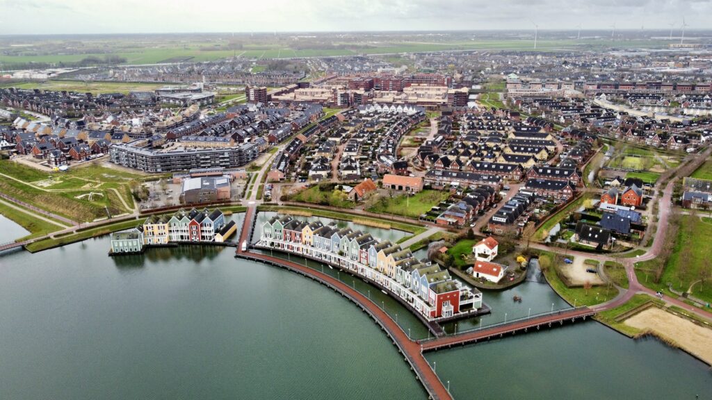
In the Dutch suburbs, such as the city of Houten, several elements come together with this concept of cluster-typedevelopments. Many public parks, open spaces, and greenways interconnect neighborhoods, village centers, shops, transit stations, and recreational areas. Within the greenways are typically small bike and pedestrian streets that create a park-like atmosphere when traveling from one point to another within the community. The internal streets that allow for cars are traffic-calmed, typically with elements such as brick street surfaces, raised intersections, trees, chicanes, and other design elements. Though the neighborhoods are more compact, they are quiet. Many homes still have private yards but have the convenience of being within just a few minutes bike ride to a small grocer, restaurants, and shops. Village centers typically include mixed uses with housing and smaller commercial uses catering to the surrounding neighborhoods. Placing destinations closer to where people live creates more opportunities to move about on foot or by bike, reducing the overall traffic impact.
One could drive a car to the village center and park in an underground parking lot, and go about their daily needs. We found that a more circuitous route for driving along scenic neighborhoods with little traffic congestion is better than a large direct but more dangerous and congested road to shops surrounded by parking lots rather than adjacent to a town square. The circuitous but less congested route is made possible bycreating convenient and enjoyable routes for walking and biking that link where people live to destinations they want to access.The proper human-centric design elements must be in place to ensure a compact built environment achieves the desired goals.
LFP: What is one concept or principle you would most like to see implemented in Lehi?
West: I would love to see streets and roads that create safe and enjoyable routes for all modes of travel. To accomplish this, we must continue working on the active transportation network in Lehi and ensuring easy and convenient access to existing and future transit services. The current active transportation network is not fully cohesive and does not get everyone from anywhere to everywhere safely by foot or bike. We have a connected network of streets, roads, and highways that allow you to drive anywhere, but traffic congestion has grown and will continue to worsen until we create other safe and convenient options for people to use.


